Eyes in the sky, ears in the wild
Eyes in the sky,
ears in the wild
HOW OUR STEWARDSHIP TEAM IS PAIRING ACOUSTIC MONITORING AND DRONES WITH BOOTS ON THE GROUND TO CARE FOR PRESERVES YEAR-ROUND
WRITTEN BY JON MACNEILL, COMMUNICATIONS & ENGAGEMENT MANAGER
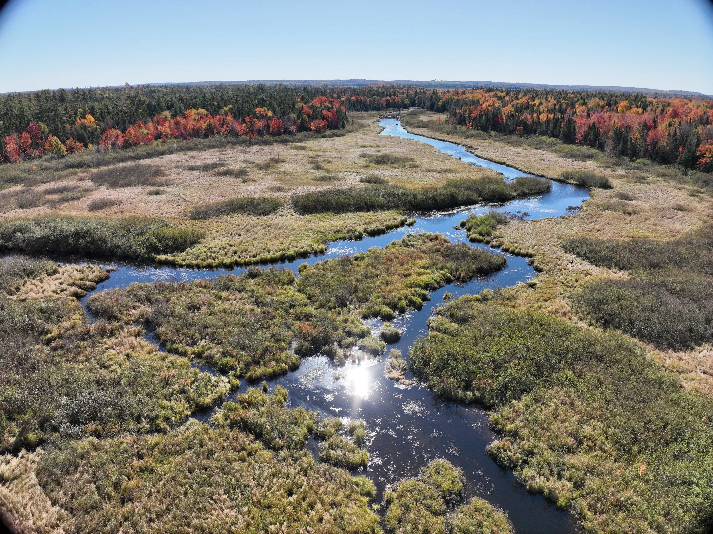
Cormorants and black-legged kittiwakes skirted curiously around our skiff as we approached the island nature preserve in the Bay of Fundy. We clamber up the cobblestone beach to a field of swirling, grassy tufts left behind by another seabird, the common eider.
When the Nature Trust established this preserve in the 2010s, it was a known nesting site for a large colony of eiders. And while the landscape is dotted with the mounds left by the ground-nesting birds, just how many still frequent the island isn’t clear. It’s costly, and intrusive, to conduct on-the-ground surveys when the birds are nesting. That’s why we’re here on this spring day, just before the eiders are due to land during their seasonal migration, installing a small, solar-powered box that will capture every sound in the area, 24/7, 365 days a year.
“This island is off limits between May and the end of August for the eider breeding period,” says Courtney le Roux, Nature Trust Stewardship Manager, after switching the device on, called an autonomous recording unit (ARU).
“We’ll come back at the end of the summer when they’re done breeding, and from the data we collect, we’ll be able to identify the different species that occur here. We can track storm severity based on the winds, and any kind of issues or encroachments—like if someone came here with a chainsaw. Even when we can’t physically be here, we can still understand what’s happening, and use that information to better care for the preserve and the wildlife that depend on it.”

Nature Trust’s Soundscape Project
Since spring 2024, our Soundscape Project has been “listening” nonstop at some our most remote and sensitive preserves. The round-the-clock audio captured by ARUs helps us track biodiversity, seasonal behavior, and potential threats without setting foot in delicate habitats during critical times.
We now have 10 ARUs deployed across our network. To date, they’ve collected more than 11,000 audio files within 2.7 terabytes of acoustic data. Identifying the bird calls is a two-step process. First, we run the files through BirdNET, a machine-learning system developed by the Cornell Lab of Ornithology, which draws upon a vast database of calls to make a first pass at identification.
Next, to ensure a high level of accuracy, our team and volunteers—including some amazingly dedicated birding enthusiasts— manually listen to the recordings to verify BirdNET’s assessment. More than 2,000 bird calls and 95 distinct species have been verified so far, including species at risk such as chimney swift, barn swallow, and Canada warbler.
There’s also been some interesting discoveries and delightful surprises, like occurrences of American bittern, a hard-to-spot wetland specialist, patterns that point to green-winged teal breeding behavior, and persistent bald eagle calls suggesting a nearby nest.
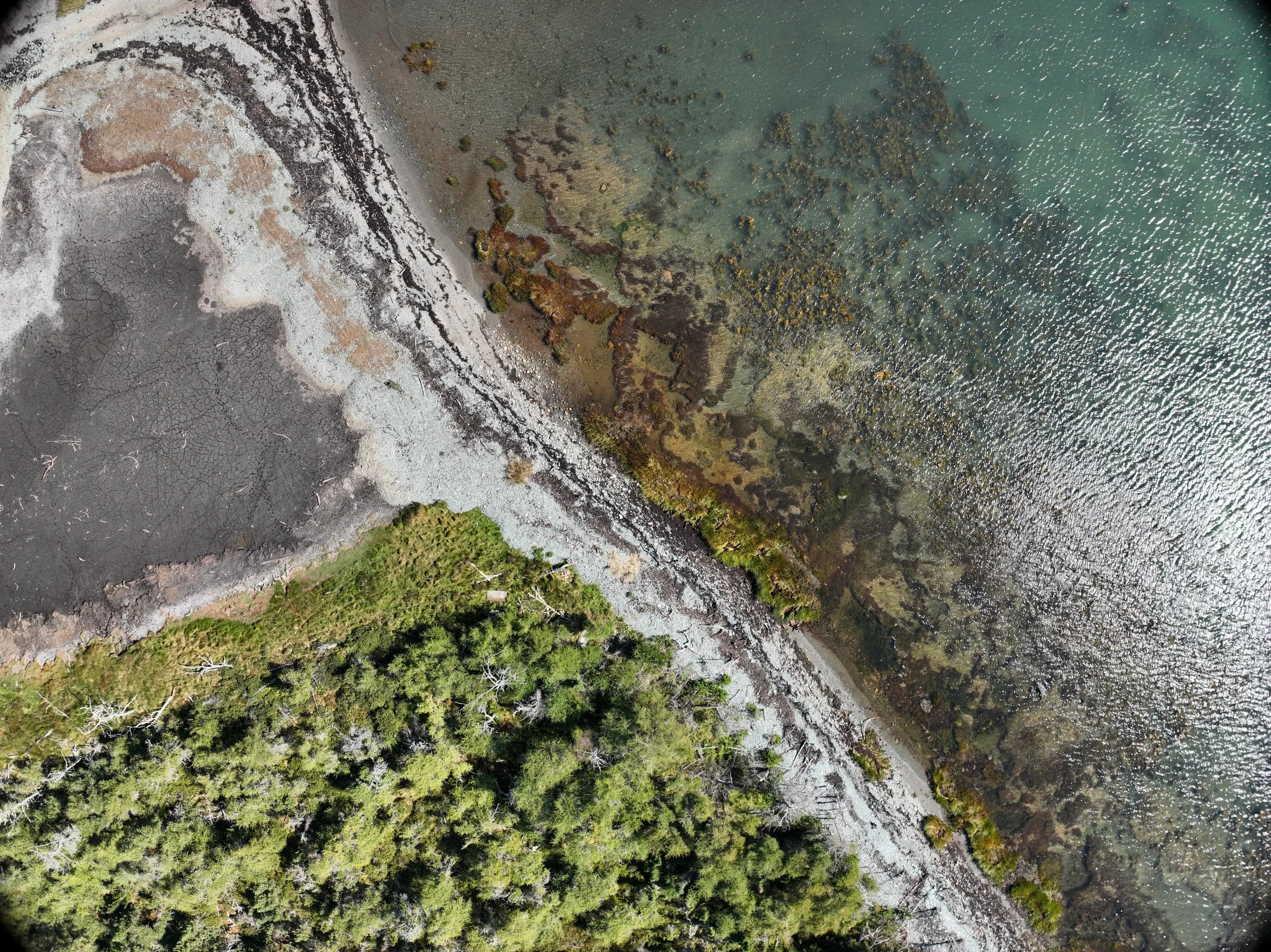
Aerial image from a drone survey of our Keiko and Errol Nature Preserve at Ross Island in summer 2025.
Adding a new vantage point: drones
That’s not the only tech our team has added to our land care toolkit. Over the past few months, we’ve started using drone surveys to give us true, high-resolution imagery over areas that are tough or unsafe to traverse on foot, like steep coastal cliffs or boggy island interiors. Drone-acquired imagery is analyzed using mapping software and, paired with historical data and on-the-ground surveys, helps us assess boundaries, spot changes early, and respond faster to issues like blowdowns, erosion, or encroachment.
Six preserves have been surveyed so far. In the future, we plan to integrate multispectral drones that detect chlorophyll and other vegetation signals that will let us flag plant stress before it’s visible, helping us spot disease, drought impacts, or invasive spread sooner.
People and tech, working together
ARUs and drones don’t replace field staff or volunteers—they just amplify what we can do on the ground.
“Acoustic data tells us who is using a habitat and when. Aerial imagery shows us where conditions are changing and how to prioritize our work,” says Shraddha Vadgama, a Stewardship coordinator who brought the idea of incorporating drones into our monitoring practices.
“Together—along with the eyes, ears, and hands of staff and volunteers—these tools help our preserves weather climate change, resist invasive species, and stay healthy for the long term.”

Volunteer with the Soundscape Project
Curious if the common eiders are still nesting at that island nature preserve? So are we! We recently collected the audio files from that site and could use your help to identify the recorded species. If you’ve got a keen ear for birdsong, or love working with audio data, we’d love to hear from you. Email steward@ntnb.org to volunteer!
This work is possible thanks to our donors and volunteers, and support from RBC Tech for Nature, RBC Net Zero Economy, McLean Foundation, Sir James Dunn Foundation, Echo Foundation, William P. Wharton Trust, and Wildlife Habitat Canada.


This story will be featured in our 2024-25 Gratitude Report, our annual report. Members and donors receive a hard copy in the mail each December—donate here to join the mailing list.